Sunday, 28 October 2012

Tuesday 3rd July - Lake Winnipeg and Gimli

We awoke on a sunny morning after a good sleep, the temperature was now 30degC and this would be fairly constant during our stay.
We breakfasted in the apartment and it seemed quite a strange thing to be doing after breakfasting in motels. The first task was to unpack for the first time and sort out our laundry.

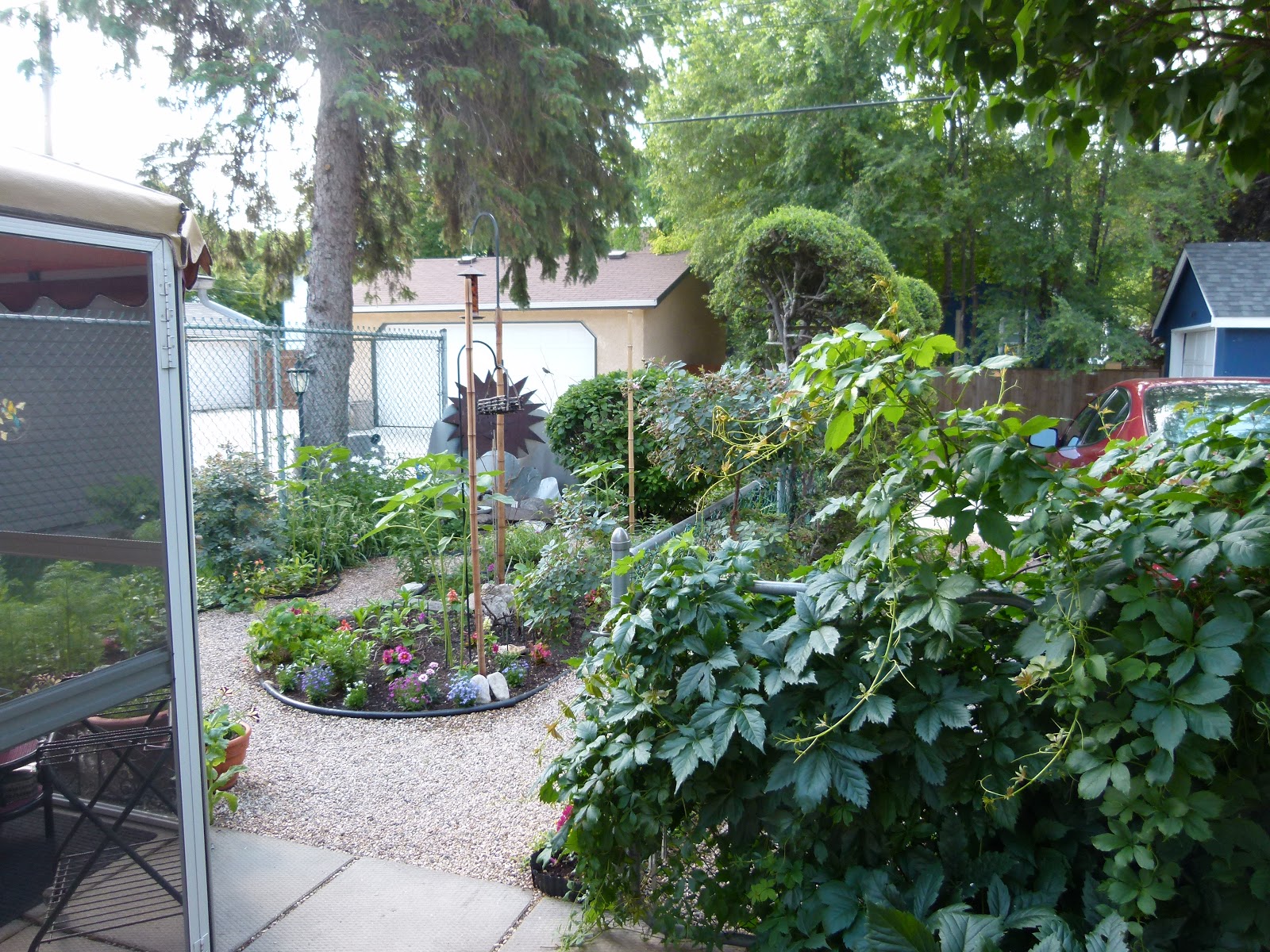
Bette's garden
We arrived at Gill's and sat in the gazebo where we found our proposed itinerary for the week and also gifts had been placed on "our" chairs.Today's visit would be to Lake Winnipeg and Gimli.
Totem Pole at Winnipeg Beach
The totem pole is a tribute to the aboriginal people of Manitoba. It was once a 6 foot thick, 30 foot cedar log from the Campbell River in British Columbia. It was carved by Peter Toth and is the 67th carving in a trail that started in 1970 and now reached throughout most of North America.
Lake Winnipeg has an area of 24,500 sq. kms. making it the world's 11th largest freshwater lake.The area is home to the Cree and Ojibway native Canadians.Hudson's Bay Co. explorer Henry Kelsey worked with them to develop the fur trade in the late 16600's. By the early 1700's there was unexpected competition for the trade and by the late 1800's European immigrants arrived on Lake Winnipeg's shores, which included a large settlement from Iceland. There are some fantastic murals on the harbour wall, but sadly I didn't have the opportunity to take photographs of them.
What fun we had!
After a short stay, we motored on to Gimli, a rural municipality, on the Western shore of Lake Winnipeg,which is only an hours drive North from Winnipeg. We lunched on locally caught pickerel from Lake Winnipeg at Kris' Fish & Chips.  Then it was time for relaxation on the white sandy beach. We set up chairs under the shade of a tree and I relaxed whist Neil and Gill went down to the water to collect rocks. On our arrival back at Gill's we were introduced to Bette and her daughter, after supper we sat and relaxed in the gazebo. How good to be able to relax outside.
                                                                                      
** Icelandic settlers quickly set up an almost sovereign nation with their own government system and laws, and the community became known as New Iceland.


Friday, 26 October 2012

Monday 2nd July - Winnipeg

At last! We're on our way to Winnipeg to see a cousin for the first time in 5 years.
We checked out at 10.30 for the short drive to Calgary airport, where we had to drop off our hire car. We were now entering the last week of our trip and, so far, all the planning had worked out. Now was to be a time of relaxation, at least 7 nights in the same bed!
A lady assisted us with the self scan check in, the airport seemed very quiet and we watched some of the Wimbledon coverage whilst we waited. Once we were in the departure lounge we were surprised to hear the announcement:"Ladies & gentlemen I should now be checking you in for flight ***** to Toronto. Unfortunately, we have lost the plane & when we find it I will make further announcements"  Well, it did make all around sit up and take note.
Our departure time was 2.30pm arriving local time 5.20. Once again we had to put our watches/clocks on one hour. We flew over Lake Manitoba and had very clear views of the land.
Gill was waiting for us in the Arrivals Hall and once we were off the escalator there was a lot of hugging! When we arrived at Gill's we were introduced to a neighbour, Bette, whose basement appartment would be our home for the following week. A night of chatting in the gazebo on a very warm night.
 

How nice to be able to go to an appartment and at last how nice to be able to unpack.
What a chagne for Neil, not to be driving.

Sunday 1st July - Canada Day

Canada Day is celebrated on 1st July across the country and marks the anniversary of the formation of the union of the British North America provinces in a federation under the name of Canada. (Akin to the U.S. July 4th) This means the year's biggest celebration!
We awoke at 8.0a.m. showered and had the hotel's "Breakfast Sampler" from the menu, we chatted to the waitress and asked where to go for the day in order to check out the celebrations.
We were not disappointed in her recommendation of Prince's Island Park & took a taxi there. A car free day for the first time in days.
Rest needed!
Peace Bridge
 On our arrival there, we passed through security and got chatting to a man who had emigrated to Calgary ten years previously. He "spotted" us by our Northern accents and it transpired that he had lived only 25 miles away!
The park was huge and had 3 performance stages where live music was being played - from heavy rock to gospel and folk. We soaked in the atmosphere and it was good to have a day of relaxation.
Children's Theatre
 The weather was gloriously sunny and a warm 20degC. We wandered over the Peace Bridge which has been built to accommodate the increasing number of people who commute to and from work, or who simply want to enjoy. The information board told us that currently 120,000 people are employed downtown and over 30,000 live in the city centre. Over 60,000 employees are expected downtown by 2025 and the population is expected to double by 2035. I was fascinated to see a piano positioned by another bridge in the park which was there purely for people to enjoy and "have a go". I somehow cannot see this concept happening here. How refreshing.
  
The park was spotlessly clean: workers in golf buggies were continually riding around to empty the numerous re-cycling bins which were staffed by attendants.
Stalls were numerous and diverse: water, food, balloons, trade and craft. The atmosphere was jovial and friendly. We felt privileged to be a part of it all. We ate at the hotel once again and had a long chat with a couple from Widnes, who were staying in Calgary to meet up with friends and visit the Stampede. Sadly, we would not see this renowned event as we would be on our travels the next day to Winnipeg for a week to stay with a cousin.  we were lucky enough to be able to see the fireworks celebrations in downtown Calgary from our hotel room.                             


Thursday, 25 October 2012

Saturday 30th June - Kootenay and Calgary

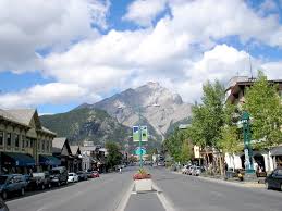
Banff Avenue & Cascade Mountain

Our request to stay at the motel for a third night was unsuccessful due to it being Canada Day the following day. The place was fully booked and so we had to telephone the hotel in Calgary to beg an extra night. (More of the travel arrangements later.)
We were bitterly disappointed as Banff Avenue was to be closed to traffic on July 1st for a day of celebrations, including a parade, which we were assured was quite a sight.
So we checked out at 9.40 on a sunny and bright morning. We first drove to the other end of Banff Avenue to have a look at the famous Banff Springs Hotel, which in some way seemed to resemble "Hogwarts". Very close to the hotel are Bow Falls, a major waterfall on the Bow River, which featured in the 1953 Marilyn Monroe film: "River of  No Return"
Bow River
Banff Springs Hotel
 Before we left Banff we headed for Kootenay National Park and Vermillion Crossing & Radium Hot Springs. Radium Hot Springs was a meeting point for plains & mountain Indians who enjoyed the soothing waters. (Kootenay means "people from the hills").
Over one million visitors annually go to absorb the hot mineral waters.
The drive proved to be a long one and the weather turned to rain and mist - Saturday again! If any one part of the trip was disappointing, to us this was it. To relieve the boredom I thought that a game of I-Spy may be the antidote.
It soon became obvious that all we could see was T, DT or R: Tree, Dead Tree or River.
The trees are deliberately set on fire to eradicate the pine bug, so there were miles of scorched looking trees.
Then we saw a big information board which informed us that we were on the Continental Divide:  a drainage divide on a continent such that the drainage basin on one side of the divide feeds into one ocean and the basin on the other side either feeds into a different ocean. All very fascinating to read about.
Continental Divide


The sign reads: on the left - Alberta, Banff National Park,
on the right - British Columbia, Kootenay National Park and the middle sign reads - Continental Divide Altitude 5382 ft above sea level/Atlantic Ocean Left & Pacific Ocean Right.
The question was: were we on Pacific time, Mountain time or British Columbia time?
We continued along the Bow Valley Trail to Radium Hot Springs, which probably has more hotel rooms, shops and coffee shops than residents. After a quick snack for lunch it was time to do the whole journey in reverse, returning to Banff before motoring on to Calgary.
  View of Calgary from hotel balcony. Spot The Rockies.
T or D.T.


 The journey from Banff to Calgary was different again: flat, pasture land with grazing cattle. The first big town was Cranmore, about 50 miles eastwards, which had once been a  booming coal mining town.
We continued to travel along Highway 1A and at one stage were surprised to see a Casino with nearby teepee's - these house the Stoney Nakoda First Nation people. Fascinating to be sitting almost side by side. The drive from Banff to Calgary is about 80 miles and takes around 2hours. We checked into our hotel: The
Radisson Calgary Airport at 6.16p.m. on a very hot evening. From our hotel room we could see downtown Calgary with The Rockies as a backdrop.
We decided to eat in the hotel, which was being decorated with hay bales and ranch fencing in readiness for the Calgary Stampede the following week.


Wednesday, 24 October 2012

Friday 29th June - Lake Louise

Charlton's Cedar Court
Hooray, a lie in - 7.45!
We breakfasted with a couple from the Medway Towns and set off into Banff to the launderette which was situated in the basement if a small shopping mall. Once we were sorted Neil went out for supplies and to find a welcome coffee. I use the term "My Beautiful Launderette" loosely, but it sure was. Potted plants and flowers decorated the place & music kept us amused whilst we washed and dried our belongings. I got chatting to a couple, he was from Dublin and she was from Vancouver and was clearly not happy with his attempts at assistance. (Well, he did put pairs of Levi's in the drier along with other washing and it was taking an age to dry)
Once completed we headed for Lake Louise some 32 miles away. On route I topped up the Canadian cell phone that I bought in Vancouver and was guided through the process by an "automated Andrea". Yes! That is how she introduced herself.
Lake Louise
 
Fairmont Chateau Lake Louise
Lake Louise was named in 1884 in honour of Princess Louise, Queen Victoria's 4th daughter. The first chalet was built on its shore in 1890, but it is probable that the first visitors arrived 10,000 years earlier. The were plenty of information boards telling its history, native wildlife and flora & fauna.
The lake stands 1731 mtrs above sea level and lies in the sub-alpine zone. winters are long and cold and summer is short and cool. The average daily temperature in January is -14deg C and +13deg C in July.
Whilst we were there the prestigious Chateau Lake Louise were putting preparations in place for a wedding that was going to take place in the grounds overlooking the Lake. What a setting I thought and at what price!
Lake Minnewanka


On the return to Banff we drove along the shoreline trail of Lake Minnewanka which translates as Lake of the Spirit. This lake is the largest in Banff National Park at 120kms long and 2kms wide at its widest point. Scuba divers are now the only ones to visit Minnewanka Landing as it is all under water,.The Lake was first dammed in1895 to improve the boggy shoreline for boating.It was dammed again in 1912 this time to store water for a downstream hydro-electric plant.Construction of the final dam occurred in 1941. More stunning scenery, the superlatives are just endless.


Once back at the hotel, it was a quick turnaround and out once again to Banff on the 7.40p.m. bus, returning on the 10.04.
We ate at the Irish Pub where live music was playing and got chatting to a couple from Lemington Spa, who were touring before meeting relatives in Calgary.


Wednesday, 17 October 2012

Thursday 28th June - To Banff


Today was a glorious sunny day and we left Jasper in all its splendour for Banff. The drive along Highway 93 is 180mls/288kms miles and it is very important to get "tanked up" as there are no petrol stations, shops, restaurants, cafes or motels along this route. The only place to stop is the Columbia Icefield Centre. I read that it is one of the "National Geographical" top ten drives in the world. It certainly did not disappoint.We stopped first at The Athabasca Falls, the Athabasca River's blue waters funnel into a chasm and break into a rapid of white water, with Mount Kerkeslin as a backdrop.
Today we saw numerous bears foraging at the roadside, as appealing as they look you have to remember that they are quite dangerous.
Following the Sunwapta River, we  climbed the height of the Sunwapta Pass, 2035mtrs.(This is the southern end of Jasper National Park.) There was a trickle of water on the valley floor and he snow was thick on the mountains - the air was noticeably colder.  In a few short miles the landscape seemed so diverse from Jasper. The Columbia Icefield and The Athabasca Glacier left us in awe. The ice has receded 100metres since 1985. I was not dressed appropriately and so stayed in the car at the edge of the glacier.Neil walked up to it and the guide had declared the glacier to be as deep as the Eiffel Tower is tall. Staggering statistics. We lunched at The Icefields Centre, where tours can be booked for helicopter rides and the all-terrain vehicle which will take you on the glacier.

 
Check out the car park


After lunch we made our descent, the pass was full of hairpin bends that could be seen from the great 
height and the cars looked like they were on a Scalextric. A bear walked right in front of our car to cross the road and then we came across a herd of Bighorn Sheep. We stopped to watch the sheep for a while. One of the smaller ones was not as sure footed and as it tried to climb the shale it kept slipping downwards. Eventually, one of the older and wiser ones helped it by supporting it on its back. Quite a sight to see. A real family effort!
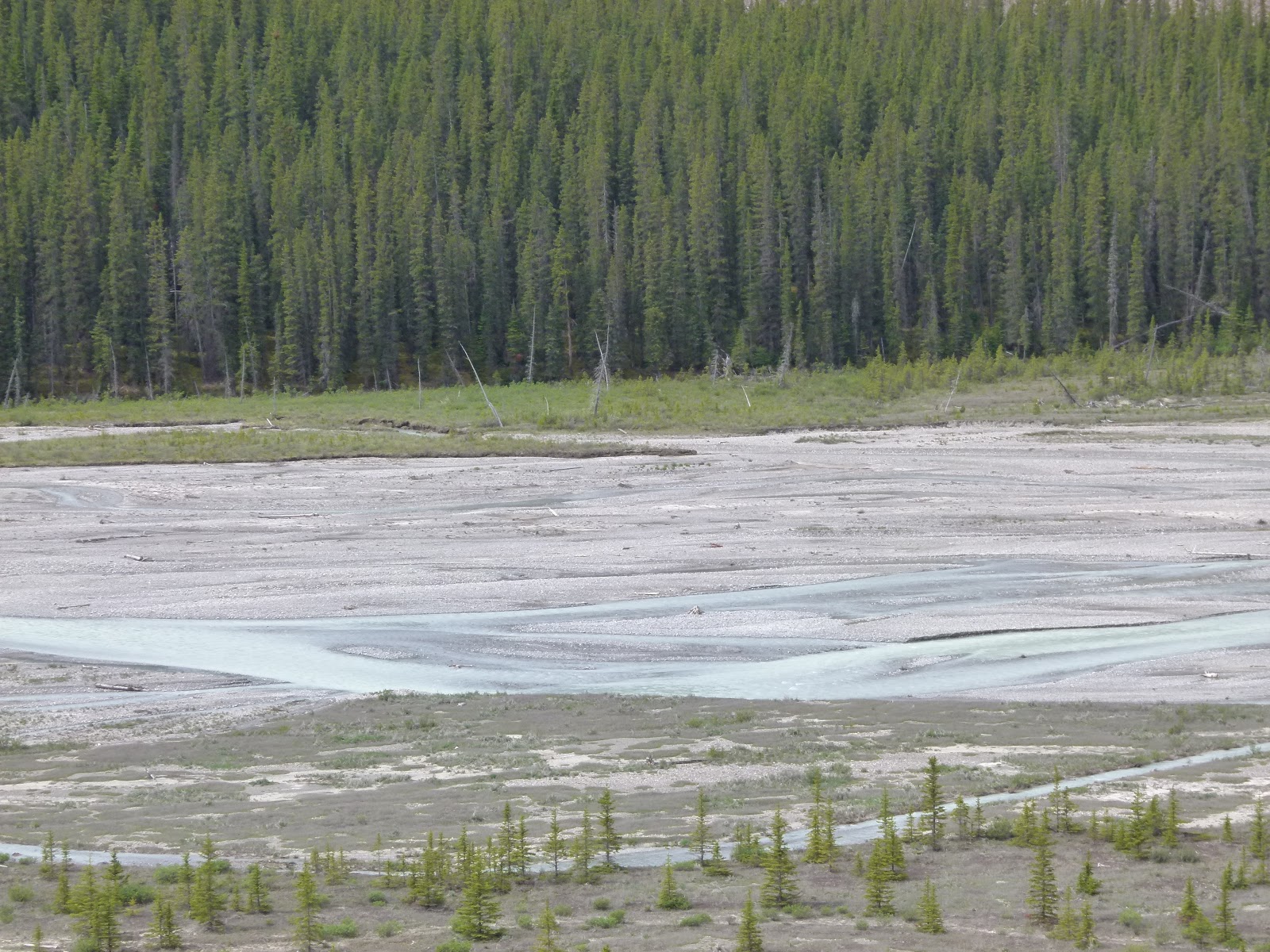

Our next point of interest on this magnificent day was Bow Glacier, which is around 23miles from Lake Louise.Bow Glacier is an outflow glacier from the Wapta Icefield which rests along the Continental Divide. Run off from the glacier supplies water to Bow Lake and the Bow River.

 
 We arrived at our next stop, Charlton's Cedar Court, at 6p.m. and we would stay here for the next two nights. We booked the hotel by phone from Jasper by opening a magazine and picking it at random. This proved to have been a good choice. After emailing family and freshening up we headed into Banff by bus to eat at Tommy's neighbourhood pub. The evening was bright and sunny and we ate outside. 
We returned to the hotel  by bus and once we got off we waited for the driver to move on before we pressed for the Pelican crossing. Well, the driver got off the bus, pressed the button and lights came on in the road surface which marked out a safe passageway! Almost like airport landing lights. The driver then stood in the middle of the road, stopping  any potential drivers and waved us across! Such service.
A fabulous day, with such diverse scenery all in some 180miles.


Wednesday 27th June - Jasper Tramway

Jasper National Park's Jasper Tramway is the longest and highest guided aerial tramway in Canada & the only guided ropeway in the Rockies. Once at the summit you can see 6 mountain ranges, glacial lakes, the Athabasca River and Jasper town. The summit is 1304mts/4279ft above sea level and there are hiking trails, off the boardwalks, to the summit.
Jasper from the summit


Our alarm went off as usual at 7.30, but after a leisurely shower and breakfast in the "comfort of our own home" we set off for the Jasper Tramway Station.
The view from the summit was stunning: an overall aerial view of Jasper including the train line, the Athabasca River and Edith & Annette Lakes.
We walked on the boardwalk for all round views, choosing not to walk to the summit.


The wildlife continued to enthral us and once we had returned to the Lower Station this little fellow was waiting to greet us!
Brrr, plenty of snow


Wapiti
We motored on to Maligne Canyon where we had lunch. The owners of the cafe told us that they had been there for 47 years and the water level was the highest that they had seen.
Chipmunk

Wapiti, just outside Jasper town

Lake Edith/Annette?
Cleaning the car windows
 Our intention was to visit Maligne Lake, but as we appeared to have low petrol & signs warning of no petrol station for miles, we opted to visit Medicine Lake, followed by Lakes Edith & Annette. On our way to Medicine Lake we came across a significant amount of parked cars by the roadside, this usually indicated a "wildlife alert". However, it was not to be on this occasion. Due to the high levels of rain the rivers were quite swollen and we soon found to our astonishment that people were kyaking down the rapids. Quite a sight and in our opinions quite mad to be doing it!

Medicine Lake
 On our return to Jasper the weather had become warm and sunny. After a coffee stop we sat opposite the train station and watched as the VIA Train loaded passengers and supplies. The passenger trains have many carriages, and the freight trains are just awesome.
On our return to the appartment we wrote our few postcards and headed out to Earls once again for our evening meal.
* Mount Edith Cavell and Lake Edith are both
 named after Edith Cavell the British nurse who worked in Begium in WW1. She was executed for assisting POW's to escape from German occupied Belgim.